 Standing on the Yosemite Valley floor and looking up, it seemed like a good idea when Cheri suggested we hike to the top of Yosemite Falls. There's a good trail all the way up, she said. Looking at the picture above, you can see the draw above the lower falls, cutting to the left and then around the granite cliff and to the right where the upper part of the trail goes. The lower part of the trail starts about four tenths of a mile to the West (left in this picture) and makes a series of steep switchbacks up to about the level of the highest part of the lower falls, and then traverses the ledge to where you get a good view of the upper falls. We ended up on the granite point just left of and above the upper falls. Click on these pictures for the full effect.
 The sign says it's only 3.4 miles. What it doesn't say is that the first 2 miles is nearly straight up, and the last mile and a half is covered in snow and ice.
 This is a view of the upper falls. The white stuff at the bottom of the falls is ice. The ice cone at the base of Yosemite Falls is sometimes referred to as the "snow cone." The super chilled water freezes on descent and forms ice crystals. Some of the ice forms on the rock walls and when it breaks off it makes loud noises, like thunder. Some of the ice from the snow cone, together with ice formed in the lower falls and ice that forms in the stream, forms a slushy deposit in Yosemite Creek below Yosemite Falls known as frazil ice - a phenomena seen in Yosemite only in March and April. We saw it and I got some good pictures, but instead of posting my pictures I am posting this YouTube video about frazil ice. It is amazing to watch, and educational.
 From the trail there are great views of Yosemite Valley below.
 The trail next to the base of the upper falls was also covered with the ice blown from the upper falls. Above that point, most of the trail was covered in snow.
 Looking back down through the draw the trail goes up, you get a sense of just how steep this trail is. If you haven't been training or working out, you will want to take a different and slightly saner hike. Like from your car to the visitor center, where you can look at pictures of the upper falls. Or something like that.
 By the time they get near the top, some hikers have really gotten beat down. Cheri kind of lost her head for a moment.
 The upper rim of the canyon had a 6 to 10 foot snow base, give or take. The trail was slippery, but well packed in most places.
Tired, but victorious, we made it to the top. The struggle was worth it, as I was treated to a rare view of Pink Dome gleaming in the sun.
 Getting out on the edge and looking over was not really advisable here.
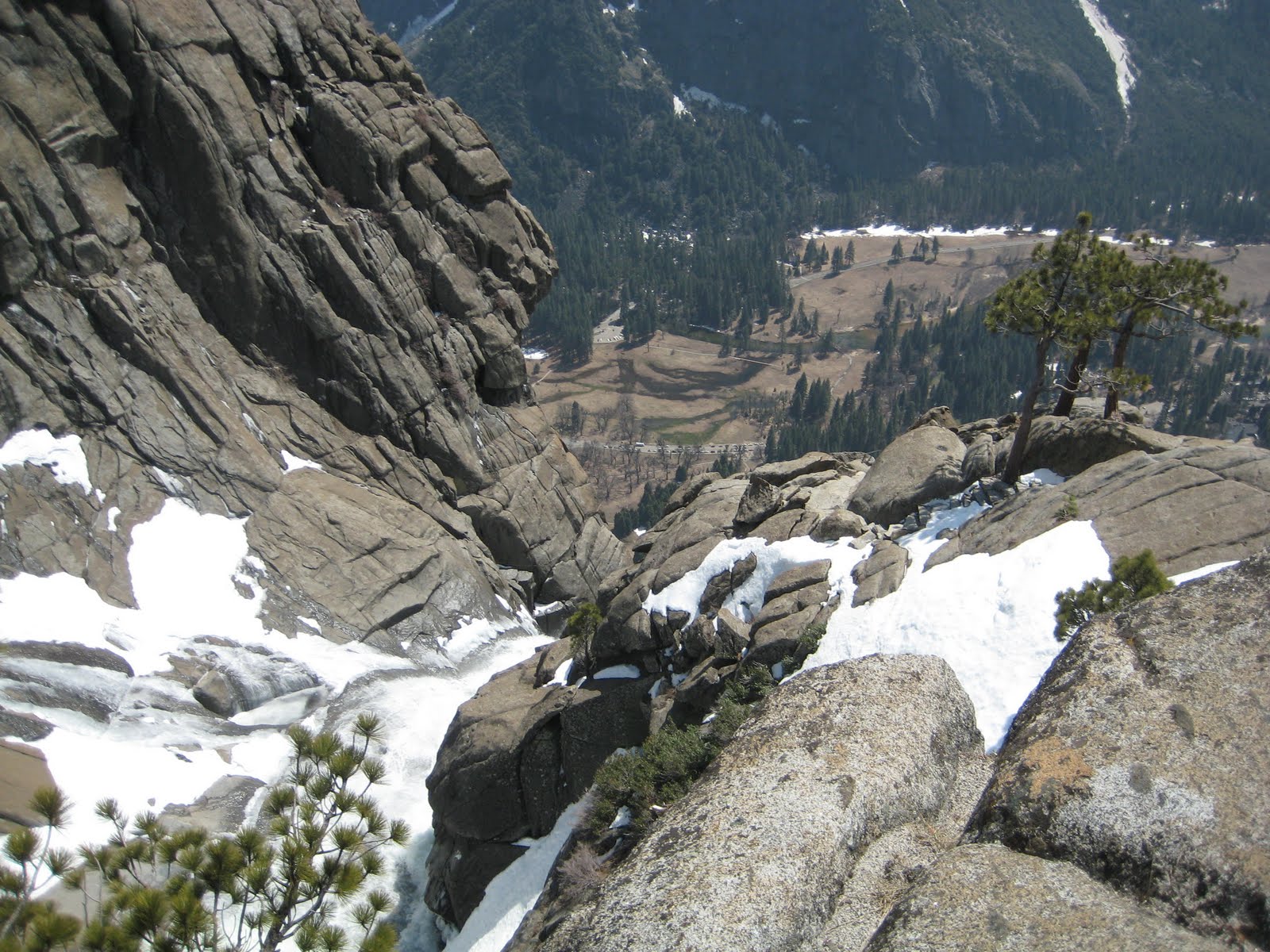 But like I said, you can lose your head getting up here. So I lost mine and went out to the edge and looked over anyway. It's a spooky-long way to fall. I'd get frazzled too, falling over this precipice all the way to the bottom.
 The trail was slippery going down. And she was tired already. What-ever!
It is tough enough dry, but at least it wasn't 90 like our last time.
ReplyDeleteBeautiful scenery, impressive falls... I was there about 40 years ago with a toddler and never attempted the hike. Probably just as well...
ReplyDelete